Public-Facing Solution Story
A practical, human-centred domestic blueprint for safeguarding biodiversity where we live.
A practical domestic solution to biodiversity loss: build a connected network of well-run reserves on land, in fresh water and at sea.
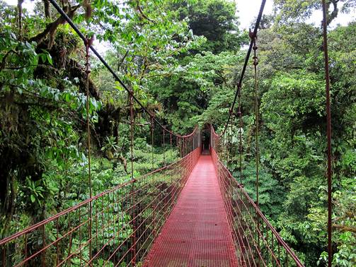
Image credit: Haakon S. Krohn, “Monteverde puente”, Wikimedia Commons, CC BY-SA 3.0. https://commons.wikimedia.org/wiki/File:Monteverde_puente.jpg
🌱 The solution in a nutshell
Protect the habitats that wildlife needs most, then manage them properly. A reserve is more than a line on a map: it needs local consent, clear rules, trained people, reliable funding and checks that nature is actually recovering.
The practical aim is a connected safety net of forests, wetlands, rivers, coasts and sea areas that keeps species, water supplies and livelihoods more resilient.
⭐ A real-life success story
Costa Rica’s National System of Conservation Areas (SINAC)
- Where: Nationwide, through 11 conservation areas on land and the Cocos Marine Conservation Area at sea.
- Who: SINAC, communities, landholders, Indigenous peoples, civil-society partners and national government.
- What they did: Built a national network of protected areas and joined it to forest incentives, restoration, monitoring and participatory governance.
- What happened: The September 2026 Protected Planet profile records 170 protected areas, covering 26.56% of land and inland waters and 28.38% of marine and coastal waters; 111 sites have recorded management-effectiveness evaluations.
- How long it took: Decades of continuing policy, from the 1970s onward; protection, financing and management are ongoing tasks.
End with the most important lesson:
Protecting more places matters—but the places must be chosen well, connected, properly funded and run with the people who depend on them.
Why does this matter?
What is happening? Wild species are losing the places where they feed, breed and move. Forest clearing, damaged rivers, destructive fishing and roads can split habitats into small islands that cannot support healthy populations.
Why should we care? Healthy habitats support food, clean water, coastal protection, pollination, recreation and local livelihoods. When they fail, households and public services often pay the price.
Why is this solution worth knowing about? Protected areas can hold the core habitats that nature needs while creating a practical framework for stewardship. The global goal is not simply to count hectares; it is to conserve the right places effectively, fairly and as a connected system.
Plain language note: “effective management” means having people, money, rules and local support to achieve conservation results—not just an official designation.
How to do it
You do not need to solve everything at once. Start with a short, public plan for the places nature needs most, then build it step by step.
1. Map the irreplaceable places
Bring together local knowledge and current maps of threatened species, nesting or spawning grounds, intact habitats, drinking-water sources, floodplains and migration routes. Identify gaps in the existing network before selecting new sites.
2. Agree rights and rules before drawing boundaries
Work with Indigenous peoples, local residents, fishers, farmers and landholders from the start. Respect land and resource rights, obtain free, prior and informed consent where applicable, decide which uses are compatible with conservation, and set out fair benefit-sharing arrangements.
3. Build a connected network, not isolated islands
Use a mix of strict reserves, community-managed areas, sustainable-use zones and wildlife corridors. Link land, rivers, coasts and sea areas so that species can move and ecosystems can cope better with heat, storms and other change.
4. Fund the job and enforce rules fairly
Budget for rangers, local monitors, equipment, ecological surveys, restoration and dispute resolution. Pair transparent enforcement with education and incentives; do not rely on penalties alone.
5. Measure what changes and adapt
Publish a baseline and a simple annual scorecard: habitat condition, key species, illegal activity, local benefits and management actions completed. Review boundaries and rules when the evidence shows a gap or a failure.
Start small. A town, catchment group or coastal community can begin by mapping one threatened habitat, convening the people affected and agreeing one feasible protection-and-management action while national measures are pursued.
What difference could it make?
| If we do this… | We could see… |
| Select new sites from evidence and local knowledge, not convenience. | More of the habitats, species ranges and migration routes that are currently missed by the network are protected. |
| Fund rangers, community monitoring, maintenance and fair enforcement. | Fewer “paper parks” and a clearer link between the designation of a site and real conservation work on the ground or at sea. |
| Track habitat condition, key species and local outcomes, then adjust. | Public evidence for expanding, improving or changing a reserve instead of relying on promises or area totals alone. |
Measured example: Costa Rica’s September 2026 protected-area profile records 13,548 km² of land and inland waters and 165,109 km² of marine and coastal waters within protected areas. Those coverage figures are management indicators, not proof on their own that every species is recovering.
What are the catches?
No solution is perfect.
- A boundary on a map does not stop damage. Every site needs people, rules, monitoring and recurring funding.
- If local and Indigenous rights are ignored, restrictions can shift costs onto communities, create conflict and undermine conservation.
- Land purchase, compensation, patrols, restoration and remote marine management can be expensive; the largest costs continue after designation.
- A protected area cannot on its own fix pollution, climate change or a fragmented landscape. It must be linked to action beyond its boundaries.
- Area coverage is easy to count, while wildlife recovery takes time to measure. Good baselines, open data and independent review are essential.
The honest test is not “how much land or sea was labelled protected?” but “which places are healthier, who shares the benefits, and what does the monitoring show?”
📚 Want to go deeper?
Three reliable sources for readers who want the full story.
1. Convention on Biological Diversity — Target 3
Plain-language guidance on conserving 30% of land, inland waters, coasts and seas effectively, fairly and as a connected system.
Read more → https://www.cbd.int/gbf/targets/3/
2. Protected Planet — Costa Rica country profile
The current World Database on Protected and Conserved Areas profile for Costa Rica, including coverage and recorded management-effectiveness evaluations.
Read more → https://www.protectedplanet.net/en/country/CRI
3. González-Maya et al. (2015), PLOS ONE
A peer-reviewed assessment showing why species representation and range coverage are more informative than simply adding up protected-area totals.
Read more → https://pmc.ncbi.nlm.nih.gov/articles/PMC4430271/
The evidence
Where has this been tried? Protected-area networks operate worldwide. This story draws its practical example from Costa Rica, where SINAC has linked protected areas with wider forest, wildlife, water and watershed governance across 11 conservation areas.
What does the evidence show? The Costa Rican case demonstrates that a national system can reach substantial land and marine coverage and make management evaluation routine. Its forest recovery has also been associated with a broader policy mix that included protected-area governance, incentives, restoration and monitoring—not protected areas alone.
How strong is the evidence? The case is supported by official institutional and protected-area data, a World Bank synthesis and peer-reviewed research. The research also provides an important warning: a 2015 mammal study found 98.5% of species present in at least one protected area, yet 25% were underprotected against representation targets.
What do we not know yet? Coverage does not reveal whether rules are enforced consistently, whether each site is adequately resourced, or whether every group shares costs and benefits fairly. Ecological effects vary by species, habitat and pressure, so outcome monitoring must continue.
At a glance
| At a glance | Details |
| Problem | Biodiversity loss from habitat destruction, fragmentation, overuse and weak protection. |
| Solution | A connected, equitably governed and well-managed network of protected land, freshwater and sea areas. |
| Works at | National, regional and local levels; connections across boundaries make it stronger. |
| Typical timescale | 1–3 years to map, agree and designate priority sites; ongoing management; 5–10+ years for many ecological outcomes. |
| Approximate cost | Moderate to high and recurrent. Costs include planning, rights and benefit arrangements, staffing, monitoring, restoration and enforcement. |
| Evidence | Strong conservation rationale; outcome evidence is mixed and context-dependent. Coverage alone is not an outcome. |
| Main benefit | Secures core habitat and ecosystem services while creating a durable framework for local stewardship. |
| Main limitation | Can become a “paper park” or create unfair burdens if funding, rights and accountability are weak. |
🔗 Related solutions
- Restore damaged habitat and wildlife corridors outside reserves.
- Use payments for ecosystem services to reward conservation by farmers and landholders.
- Co-manage fisheries with sustainable catch rules, local monitoring and protection for breeding grounds.
Library note: This story follows the public-facing format of the GSTIA Open Library of practical solutions to the polycrisis.
Editorial principle: This is an evidence-grounded public guide, not an academic review. It reports what appears to work, where it works, what it costs and where the evidence remains uncertain.